You do not need a new instrument to get better weather data. Most of the time you need to move the one you have, or accept what it is telling you and buy a second one somewhere else. That is the actual decision behind weather station siting, and it rarely gets framed that way. It gets framed as a checklist: put it here, not there, done. The checklist is fine as a reference. It will not tell you whether your current station is worth trusting, or what to do if it is not.
Measured by NuaSense weather stations and soil probes on Kenyan farms, over the period stated with each figure. Past readings, not a forecast.
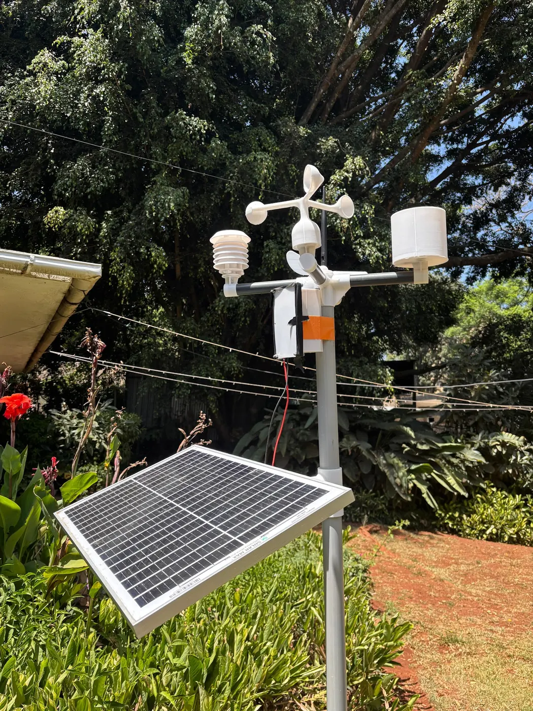
What a badly sited station actually gets wrong
A station reads exactly what is happening at its own instruments. The problem is that a farm manager reads it as if it describes the block. Those are different claims, and the gap between them grows with every metre of bad exposure. A temperature sensor too close to a wall reads the wall's heat, not the crop's air. A rain gauge tucked against a fence catches less rain than the open field beside it. The fence disturbs the wind that carries drops sideways. Cornell's placement guidance for its NEWA network is blunt about this: the windier the gauge location, the greater the precipitation error. That is a mechanism, not a rounding error. Two gauges under different wind exposure can disagree on a storm total by a meaningful margin, without either one being broken.
The Springer chapter on weather station siting makes a similar point about temperature. Agricultural stations are meant to read air at 1.5 to 2.0 metres, the height a crop canopy actually experiences. National weather services measure at 10 metres, for a different purpose entirely. If your station copies the placement logic of an airport mast, because that is what a technician had seen before, you are answering a question nobody on your farm is asking.
None of this shows up in the app. The dashboard will render a clean line for temperature, rainfall and wind. From the graph alone there is no way to tell whether the number is representative or just consistent. Consistency and accuracy are not the same property, and a station can be perfectly consistent about being wrong.
The obstacle rule that most farms already break
There is a specific number worth carrying in your head before the next walk out to the mast. Weather stations should sit at a distance of roughly ten times the height of any nearby obstacle, according to the Arizona Extension growers' guide on weather station selection. A three-metre fence line, a shed, a row of trees along the boundary: each needs ten times its own height of clear space. Only then does the station stop feeling its presence in the wind and temperature record.
Cornell's guide narrows this for the temperature sensor specifically: the radiation shield should sit no closer than four times the height of any obstruction. The sensor itself belongs at least 100 feet from any paved or concrete surface. Pavement heats and cools on its own schedule, and drags the reading with it. Most farm stations were sited for convenience: near the gatehouse, near power, near where someone could keep an eye on it. Convenience and clear exposure rarely point at the same patch of ground.
Shade is the other quiet failure. A station should not be shaded during any part of the day. Shade lowers the solar radiation reading, and everything downstream that depends on it, including the derived spray window score most stations now compute. A station that sits clear of shade at 10am and under a tree's shadow by 3pm gives you an afternoon reading that belongs to the tree, not the field.
The WMO classification exists, and almost nobody in East Africa runs it
There is a formal answer to whether a station is sited well enough, and it comes from the World Meteorological Organization's siting classification standard, ISO 19289:2014. It grades a site on a numbered scale. Class 1 for wind measurement requires a clear radius of 300 metres around the mast, a distance that rules out the vast majority of farm plots outright. Classifying a new site takes about 20 minutes, on top of the walk-around that ought to happen anyway. The standard notes that some national services, Meteo-France among them, take closer to two hours to do it properly. The classification is static: it gets assessed at most once a year, not reset every season. Siting quality changes slowly, through tree growth and new construction, not through weather.
Almost no commercial farm in Kenya runs this classification. There is a reason beyond neglect. The standard was built for national meteorological networks reporting into global models. There, a class 1 or 2 site matters for comparing one country's station to another's. A farm station answering an irrigation or spray-timing question on one block does not need that level of formality. What it needs is the underlying discipline: know what is around the mast, know how far it is, and know which readings that distance is quietly degrading. It is worth borrowing the WMO's habit of thinking in clear radii without adopting its full class 1 requirement. For a single-farm station, that is the honest compromise.
Fix it in place, move it, or add a second station: the actual choice
Once a site problem has been found, three responses are on the table. They cost differently. Fixing in place means trimming or removing the obstruction: a fence, an overgrown hedge, a stack of empty pallets. It usually costs nothing but labour and one afternoon. Relocating the mast means digging a new footing and running power or checking solar exposure at a new spot. It costs a half day and the awkwardness of a data gap while the old and new series don't overlap cleanly. Adding a second, cheaper station at a different point on the farm is worth taking seriously if the block has real internal variation, a slope, a dam, a shelter belt. One well sited station still only describes one point.
The IWMI mobile weather station programme is useful here as a cost anchor, even though it was built for a different context. Its low-cost solar units run about $350 each and last up to ten years. The programme's own accounting has them paying for themselves within about two and a half years. That arithmetic does not transfer directly to Kenyan commercial farm budgets. The IWMI figure comes from a development deployment, not a for-profit block. But it does establish that a second unit is not automatically the expensive option relative to relocating or maintaining a single premium mast.
Weighing the three, side by side
Written out as a table rather than a paragraph, because the trade-offs really are the whole argument here.
- Fix obstruction in place: cost is a few hours of labour, no equipment, no data gap. Buys: correct exposure at the mast already trusted and already carrying history. Does not buy: coverage of a second part of the farm.
- Relocate the mast: cost is a half day of work plus a break in the continuous record while old and new sites don't overlap. Buys: a genuinely better site if the obstruction cannot be removed, for example a permanent building. Does not buy: any new coverage; it is still one point on the farm.
- Add a second station elsewhere on the farm: cost is roughly the price of a unit, on the low end near the IWMI $350 figure for that programme's hardware, running alongside the first. Buys: a real second data point, which matters more on farms with a slope, a dam edge or a shelter belt than a marginal siting fix does. Does not buy: a solution to the first station's siting problem if it has one; there are now two datasets, one of them still compromised.
The honest recommendation is to do the obstruction fix first, because it is nearly free and it removes doubt about the record already collected. Whether relocation or a second unit comes next depends on whether the problem is local, a fence that can be cut back, or structural, a shed that isn't moving. A shed forces relocation. A slope or a dam edge argues for a second station regardless of what happens to the first.
What our own network shows about how much stations can disagree
It helps to see how far apart two properly running stations can land. That sets expectations for what siting error adds on top of the baseline spread. Across 8 NuaSense weather stations in Kenya, rainfall totals over the same period, 3 to 30 August 2026, ranged from 0.0 mm at one station to 157.8 mm at another. These stations are not co-located, and this is not a single region's rainfall. It is the measured spread between farms on the network. It is a reminder that a single gauge, however well sited, describes its own patch and nothing further. Air temperature over the same window, across all 11 stations, ranged from 3.9 to 31.3°C with a mean of 17.3°C. Humidity averaged 72%, swinging from 17% to 100%. None of that range is an error. It is the country doing what it does across altitude and microclimate. And it is exactly why a farm cannot borrow another farm's station and call the reading its own.
This is also why obsessing over a single mast's siting only gets you partway. A correctly sited station on one farm still only tells you about that patch of ground. If the farm has real internal variation, and most commercial blocks in Kenya do, the siting conversation and the coverage conversation are two separate decisions. Only one of them is solved by moving a mast.
Data gaps are already the norm, not the exception, across the region
The siting question sits inside a bigger shortage. Weather stations across much of Africa are sparse. The CGIAR assessment of weather and climate services in the region notes their numbers have been declining over the last half century. Most of what remains is clustered in towns and along main roads, precisely the sites least representative of farmland. Automatic weather stations that do exist report at a fine 15-minute average resolution but carry high maintenance costs. Spare parts are frequently not available locally, so a broken sensor can sit unfixed for a season. Different donors have funded different AWS types over the years, and the resulting datasets do not line up cleanly with each other. That is part of why the AICCRA automatic weather station data tool exists at all: to help national meteorological services in five countries, Ethiopia, Ghana, Kenya, Rwanda and Zambia, stitch fragmented networks into something usable.
A farm that owns even one well sited station is, in this regional context, unusually well informed. That is worth stating plainly, because it reframes the siting conversation. The comparison is not against some ideal national network. It is against the nearest official station, which may sit far away along a main road and describe conditions nothing like the block in question.
The gap between owning weather data and trusting it
There is a specific piece of research from Kenya worth sitting with. In Rarieda constituency, research on weather and climate information needs of small-scale farmers found that 92% of farmers already receive some form of weather and climate information, but only 14% find it useful. That is not a data-access problem. It is a trust and relevance problem, and siting sits close to its root, because information that does not describe a farmer's own block, own microclimate, own exposure, earns exactly the scepticism it deserves. The same research found that long-term forecasts meaningfully influenced land preparation, seed choice and disaster management decisions, while daily forecasts showed no statistically significant influence at all. And 89% of respondents said they were willing to pay for better weather information, correlated with wealth.
Read against the siting problem, this is a warning against buying a station and treating ownership as the finish line. A poorly sited station on a farm can produce the same 92-versus-14 gap in miniature. Data arrives on schedule and is trusted by nobody, because one bad storm total or one obviously wrong hot afternoon has already taught the farm manager to discount the whole feed. Getting the siting right before the short rains is partly a technical fix and partly the thing that determines whether anyone on the farm bothers to open the app in November.
The rain gauge deserves its own walk-around
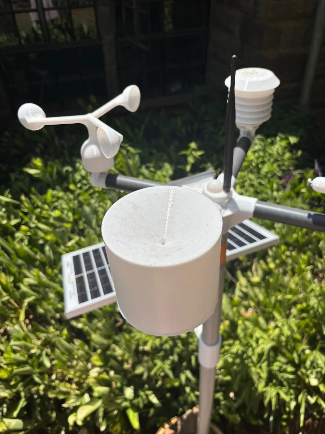
Rainfall is the reading with the most siting-specific failure modes, and it is also the one the short rains will punish first if it is wrong. Cornell's placement guide is specific: the gauge should be as level as possible, and the best site is protected in all directions. An opening in a grove of trees is the model case. But the height of that protection should never exceed twice its distance from the gauge, otherwise the surrounding cover starts blocking rain rather than just wind. Get that ratio backwards and the result is a rain shadow built around the instrument itself.
Leaf wetness sensors have their own fixed orientation rule worth checking at the same time as the mast. They should face north and sit at 45 degrees from horizontal, a detail easy to get wrong on installation and never revisit. And every instrument on the mast, gauge included, should be kept clear of spray applications, since agrochemical drift can damage sensors or introduce readings that have nothing to do with weather.
The network's own record gives a sense of how rare rain actually was during the recorded period. Only 99 of 4,062 ten-minute readings across the network carried any rain at all, about 2.4% of the record. When rain is this infrequent, every tip the gauge misses to wind or misalignment is a larger share of the eventual total than it would be in a wetter month. That is exactly the argument for checking the gauge now, before the short rains arrive, rather than after the first storm has already been under-recorded.
What to actually walk out and check this week
Put the checklist in an order that matches how a farm manager actually moves around a mast, not the order a manual lists it in. Start with obstacles. Pace out ten times the height of the nearest fence, shed or tree line and see whether the mast clears that radius; if it doesn't, decide whether the obstruction is removable. Move to the rain gauge specifically. Is it level? Is the surrounding cover no taller than twice its own distance from the gauge, and has wind exposure gotten worse as a nearby hedge grew this year? Check the temperature sensor's height against the shield's clearance from anything nearby. And check that no part of the mast sits in shade at any hour it has been watched. Confirm nothing sprays directly across the instruments during a normal chemical application round.
Then step back and ask the coverage question separately from the siting question. Does one station, however well placed, actually describe the parts of the farm that matter for this season's decisions? If the answer is no, because of a slope, a dam, or a block on the far boundary that behaves differently, that is the case for a second unit rather than a better single mast. This is a different decision from the gauge-accuracy question covered in our piece on how much a single rain gauge undercatches and how far apart gauges need to be. But it belongs on the same pre-season list: both are checks worth doing in the weeks before planting, not during it. For growers weighing a full monitoring setup rather than a single mast, the sensor and station options are laid out on our weather stations and wind sensor pages. Those pages also show how the derived figures, ET0, spray windows, leaf wetness, actually get computed from the raw readings.
None of this replaces judgement. A station sited exactly to the WMO's class 1 radius on a smallholder plot is a fantasy; the standard was written for national networks with room to spare. What is achievable, and worth doing before the rains, is knowing precisely which of these checks a given mast fails. Treat that as a known limitation of the number, not a surprise discovered mid-season.
NuaSense has a longer piece on this. Smart irrigation in Kenya, an overview covers a practical run-through of smart irrigation technologies in Kenya. It includes drip irrigation, soil moisture sensors, solar-powered pumping, and IoT platforms. It is written from the perspective of an IoT sensor company working with farmers on data-driven water management.